
Sunday, February 12, 2012
Tugboat at sunset
OK, this is just a pretty picture, but it's good enough to share. On February 5, we saw an unidentified tug steaming northwest to southeast in Elliott Bay against the setting sun. It was too dark to identify the tug by sight and we didn't have our ShipfinderHD iPad app handy, but chances are excellent that it belonged to either the Crowley or Foss fleets that work regularly in and around the Port of Seattle.

USCG Cutter, "Fir"
The US Coast Guard Cutter Fir arrived in the Port of Seattle today. Launched in 2003 by the Manitowoc Company in Marinette, WI, CGC Fir is a buoy tender. Her home port is Astoria, OR.
According to the US Coast Guard, CGC Fir's primary mission is responsibility for more than 150 Federal aids to navigation (ATON) in the area from the Oregon-California Border to the Canadian border, including the Columbia River, Grays Harbor and Puget Sound. CGC Fir also coordinates with NOAA to maintain five weather buoys in the Pacific Ocean.
The 10-ton hydraulic crane on her foredeck has a 42-foot boom and is used for lifting buoys and other navigational aids to and from the ship. CGC Fir is equipped with a dynamic positioning system that keeps the ship within 10 meters of position in up to 30-knot winds and 8-foot seas.


Sunday, February 5, 2012
USCG Cutter Healy Returns to Seattle
Barely two weeks ago, the US Coast Guard Cutter Healy was offshore Nome, Alaska, where it had escorted a Russian tanker through 360 miles of ice to deliver 1.3 million gallons of much-needed fuel to the residents of Nome. See http://cgvi.uscg.mil/media/main.php?g2_itemId=1502057.
Today, the Healy returned to port after 254 days at sea.


You can find a series of USCG news releases describing the Nome mission at http://www.d17.uscgnews.com/go/doctype/780/48803.
Today, the Healy returned to port after 254 days at sea.


You can find a series of USCG news releases describing the Nome mission at http://www.d17.uscgnews.com/go/doctype/780/48803.
The Grounding of the Costa Concordia
OK. This has nothing to do with Elliott Bay marine traffic. Thank goodness for that.
But if you're at all interested in the grounding of the Costa Concordia, the Italian cruise ship that partially sank on Friday, January 13, 2012 after hitting a reef off the Italian coast and running aground at Isola del Giglio, be sure to read James Hamilton's post on his well-written and informative M/V Dirona blog. Based on publicly available AIS data, the post describes the path of the Costa Concordia prior to, during, and after it struck the reef. The post includes fascinating graphics describing the ship's movements after it struck the reef but before it ran aground.
But if you're at all interested in the grounding of the Costa Concordia, the Italian cruise ship that partially sank on Friday, January 13, 2012 after hitting a reef off the Italian coast and running aground at Isola del Giglio, be sure to read James Hamilton's post on his well-written and informative M/V Dirona blog. Based on publicly available AIS data, the post describes the path of the Costa Concordia prior to, during, and after it struck the reef. The post includes fascinating graphics describing the ship's movements after it struck the reef but before it ran aground.
Summer . . . in February . . . in SEATTLE?
The high temperature at Sea-Tac yesterday (February 4) was 60 degrees, just three degrees short of the record high temperature for that date. That's why these people were gathered on Pier 62-63 just before sunset.

This is what they got to see.
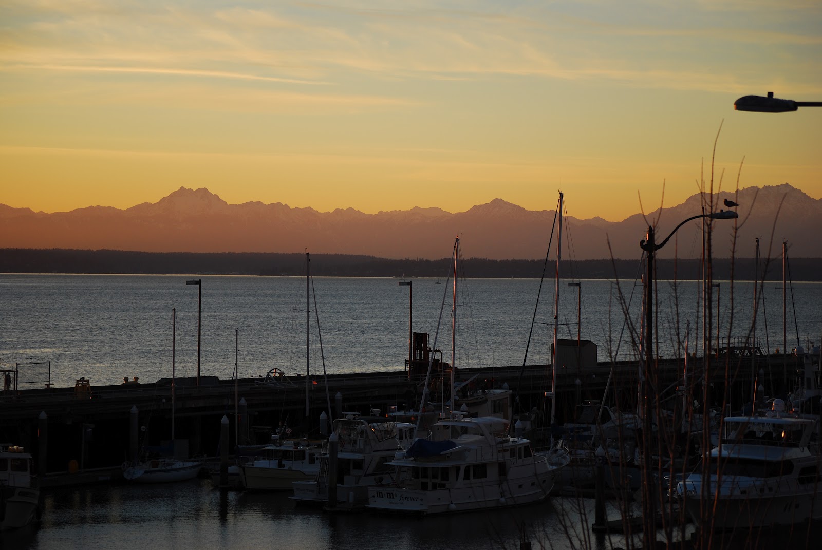
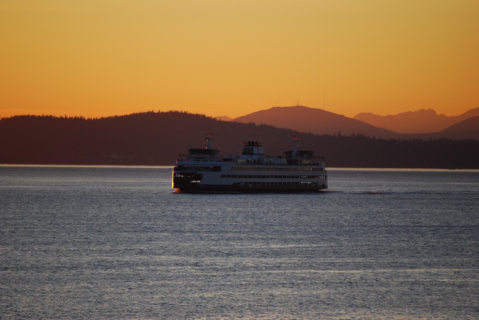
The unseasonal temperatures around Seattle were caused by a ridge of high pressure over the region that led to a strong southeasterly flow crossing the Cascades that descended over western Washington and Oregon. As that air descended the western Cascade slopes, it warmed by compression. For a compelling discussion of the conditions that led to our February "heat wave" (if 60 degrees can be called a "heat wave"), see this post on the Cliff Mass Weather Blog.
Subscribe to:
Posts (Atom)